
[Map] Operation Tempest (4km) [WIP]
-
Silly_Savage
- Posts: 2094
- Joined: 2007-08-05 19:23
Re: [Map] Operation Tempest (4km)
Looking forward to the new screens! 
"Jafar, show me a sniper rifle." - Silly_Savage 2013
-
Rudd
- Retired PR Developer
- Posts: 21225
- Joined: 2007-08-15 14:32
Re: [Map] Operation Tempest (4km)
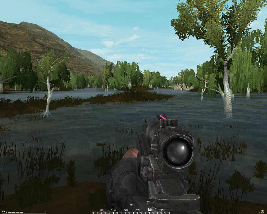
are you using the overgrowth shadowmap or just the level light settings?overgrowth colouring and everything, which has been really difficult to balance between too dark and too bright.

-
ChiefRyza
- Posts: 620
- Joined: 2008-06-29 07:37
Re: [Map] Operation Tempest (4km)
No I'm using the overgrowth shadow map as well, I'm just trying to get the balance perfect. If I make it too dark, the shadows on a lot of the trees are virtually black which looks terrible, but too bright and it all looks unnaturally green.
-
myles
- Posts: 1614
- Joined: 2008-11-09 14:34
Re: [Map] Operation Tempest (4km)
This is looking really really good!

-
JONES
- Posts: 67
- Joined: 2006-03-28 09:28
Re: [Map] Operation Tempest (4km)
Nice looking map, good terrainwork, what program did you use for the terrain, geocontrol? Also i like those jungleareas, gives a fresh feeling!
Ahh now i wish there would be a soldner/guerilla fraction sometime in pr, this kind of junglemaps always remember me on the tom clancy flick "clear and present danger" when the american secretly landed in colombia to clearout druglord supplies, but hey pr is not about special operations we all know
Ahh now i wish there would be a soldner/guerilla fraction sometime in pr, this kind of junglemaps always remember me on the tom clancy flick "clear and present danger" when the american secretly landed in colombia to clearout druglord supplies, but hey pr is not about special operations we all know
Last edited by JONES on 2010-07-19 16:52, edited 1 time in total.

-
Amok@ndy
- Retired PR Developer
- Posts: 5144
- Joined: 2008-11-27 22:13
Re: [Map] Operation Tempest (4km)
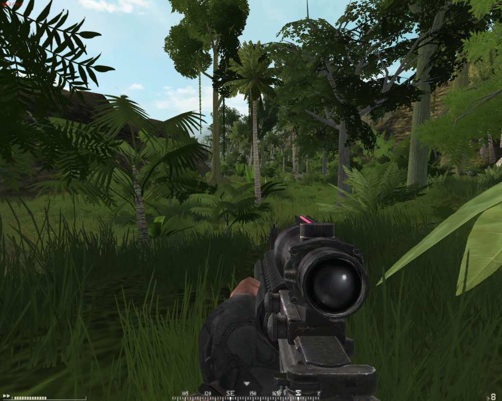
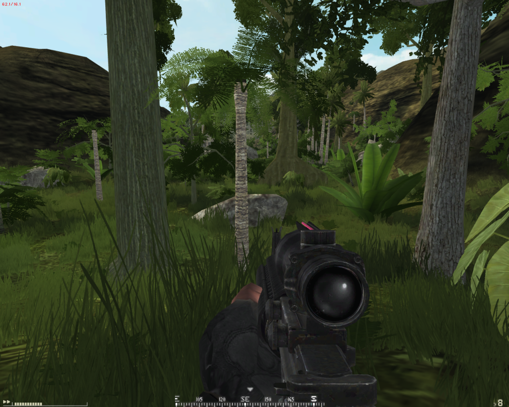
yes Jones its done in GC2ChiefRyza wrote:Hello all, been promising to show this for a while now and the day has come I think it's in an at least semi-show-able state. This is the map I started about 6 months ago for the ARF faction. Since then, it has gone through two incarnations, the first one I scrapped in favor of a terrain created in Geocontrol 2 and from there, I have been slowly building from scratch.
its definitly the best way to do terrain for games

-
JONES
- Posts: 67
- Joined: 2006-03-28 09:28
Re: [Map] Operation Tempest (4km)
@ amokandy
Hah didnt saw this, was just flying over the text and screens, yeah geocontrol2 is realy a great tool, i did the terrain for my last 2km map with it aswell, i wish i did this map for pr thought... here a overview
Hah didnt saw this, was just flying over the text and screens, yeah geocontrol2 is realy a great tool, i did the terrain for my last 2km map with it aswell, i wish i did this map for pr thought... here a overview
-
Rudd
- Retired PR Developer
- Posts: 21225
- Joined: 2007-08-15 14:32
Re: [Map] Operation Tempest (4km)
yeah I love GC2 now, used it for the first tiem this week with DEM data, very very nice program, though I like the export choices of terragen.[R-CON]Amok@ndy wrote:yes Jones its done in GC2
its definitly the best way to do terrain for games
-
ComradeChaos
- Posts: 738
- Joined: 2010-01-27 20:45
Re: [Map] Operation Tempest (4km)
GC2 is really nice, but my trial an out so I now use L3DT.
I want this map badly.
I want this map badly.
-
Brainlaag
- Posts: 3923
- Joined: 2009-09-20 12:36
Re: [Map] Operation Tempest (4km)
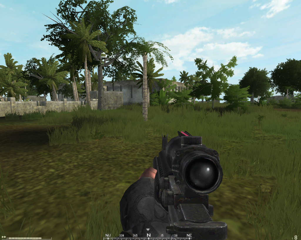
YAY Harriers looks rich in variety and reminds me of Op. Barracuda (which is good ) --> looking forward to it.
The idea about the flags is really cool but I think you´ll overdo it, 4 capable flags at a time are really too much. Anyway hope you´ll manage to balance that out, because it would be sooo uber 1337 awesome to lead a full scale assault on the beach
The idea about the flags is really cool but I think you´ll overdo it, 4 capable flags at a time are really too much. Anyway hope you´ll manage to balance that out, because it would be sooo uber 1337 awesome to lead a full scale assault on the beach
Last edited by Brainlaag on 2010-07-19 20:51, edited 4 times in total.
-
ChiefRyza
- Posts: 620
- Joined: 2008-06-29 07:37
Re: [Map] Operation Tempest (4km)
I think you misunderstood, there are 4 flags to capture in sequence per round. You take them one by one, they are set up in a sort of West-to-East format as well so it goes further inland. With 16 possible flags that are all very big and unique, it should make every round completely different.
Geocontrol 2 rocks The results you get in a matter are seconds save so much time if you were to do it by hand. At the same time though, there is a hell of a lot of hand made terrain on this map as well. As for the real-world data, it's hard to come by heightmaps for some areas if they havn't been surveyed yet. For example my other map in the Torres Strait for the ADF faction, there was literally no heightmap data available whatsoever. This map doesn't use any real world data either because I just enjoy creating something from scratch, you end up becoming a lot more attached to it as well because it is 'your' location in a sense.
its definitly the best way to do terrain for games (note: but DEM-Data)
Geocontrol 2 rocks
-
ChiefRyza
- Posts: 620
- Joined: 2008-06-29 07:37
-
Amok@ndy
- Retired PR Developer
- Posts: 5144
- Joined: 2008-11-27 22:13
Re: [Map] Operation Tempest (4km)
nice progress
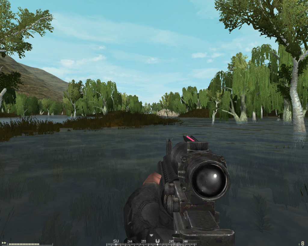
but the hills are still empty. paint a overgrowthlayer to all hills and place those overgrowthrocks then convert them to statics and replace them with vBf2 stones. then maybe adding some bushes and it should be fine
but the hills are still empty. paint a overgrowthlayer to all hills and place those overgrowthrocks then convert them to statics and replace them with vBf2 stones. then maybe adding some bushes and it should be fine
-
ChiefRyza
- Posts: 620
- Joined: 2008-06-29 07:37
Re: [Map] Operation Tempest (4km)
Would rather not massacre my performance sorry. Believe me, I tried. I don't want to have a go at you and I'm sure your going to tweak it with Jormdarreh Range but I would never allow my map to be played with less than 50FPS even with hardcore hardware. I don't know how else to explain this but If I was to cover the hills with vegetation it would:[R-CON]Amok@ndy wrote:nice progress
but the hills are still empty. paint a overgrowthlayer to all hills and place those overgrowthrocks then convert them to statics and replace them with vBf2 stones. then maybe adding some bushes and it should be fine
1) Add nothing to gameplay. Not even supposed to be fighting on those hills, they are really designed to funnel combat rather than act as playable areas. While you can still get up there your at a huge disadvantage.
and:
2) Waste precious fps merely for the sake of visuals.
To put that much overgrowth would make it jump from ~ 20,000 to about 30,000, that is a huge area to cover with overgrowth. I'm already stretching performance as it is!
Last edited by ChiefRyza on 2010-07-20 09:12, edited 4 times in total.
-
Rudd
- Retired PR Developer
- Posts: 21225
- Joined: 2007-08-15 14:32
Re: [Map] Operation Tempest (4km)
a man after my own heart, Ich liebe es
but the hills are still empty. paint a overgrowthlayer to all hills and place those overgrowthrocks then convert them to statics and replace them with vBf2 stones. then maybe adding some bushes and it should be fine
I hope you'll put alot of ambient mosquito effects
-
Amok@ndy
- Retired PR Developer
- Posts: 5144
- Joined: 2008-11-27 22:13
Re: [Map] Operation Tempest (4km)
if you want to create a map with good fps just let it empty just place the gpos ...
dont you think that that would be boring ?
having the hills that empty is just looking really bad cause you have so many vegitation everywhere but the hills
if you dont have any cover at the hills there is no chance of flanking the enemy
dont you think that that would be boring ?
having the hills that empty is just looking really bad cause you have so many vegitation everywhere but the hills
if you dont have any cover at the hills there is no chance of flanking the enemy
-
ChiefRyza
- Posts: 620
- Joined: 2008-06-29 07:37
Re: [Map] Operation Tempest (4km)
Your coming to all these conclusions about the map without even playing it. Having invested so much time into it simply to be belittled because of a few screenshots isn't very fair. There are hundreds of ways around the map, I assure you you'll be able to flank every flag from tons of areas.
-
Amok@ndy
- Retired PR Developer
- Posts: 5144
- Joined: 2008-11-27 22:13
Re: [Map] Operation Tempest (4km)
i have seen your minimap and your screenshots ...
moving across the hills with a squad is suicide
and going all around the hill to get into the valley is not really flanking ...
moving across the hills with a squad is suicide
and going all around the hill to get into the valley is not really flanking ...
-
Rudd
- Retired PR Developer
- Posts: 21225
- Joined: 2007-08-15 14:32
Re: [Map] Operation Tempest (4km)
enchance your calm gentlement we're here to advise you Chief, but its your baby
Perhaps one thing you could consider is carving tracks trough the hills according to gradients by using roads, widen teh road, apply spline, smooth it out, then either remove the road or use the path/track texture
Perhaps one thing you could consider is carving tracks trough the hills according to gradients by using roads, widen teh road, apply spline, smooth it out, then either remove the road or use the path/track texture
-
ChiefRyza
- Posts: 620
- Joined: 2008-06-29 07:37
Re: [Map] Operation Tempest (4km)
Way ahead of ya mate[R-CON]Rudd wrote:
Perhaps one thing you could consider is carving tracks trough the hills according to gradients by using roads, widen teh road, apply spline, smooth it out, then either remove the road or use the path/track texture
I'm not trying to get into an argument with you Amokandy, just trying to answer you as simply as I can - I'm probably about 50% done so what you see in the screens and minimap now will be way different in the next couple months.