Page 1 of 1
[Request] Someone with GeoControl to do heightmaps
Posted: 2010-03-29 17:37
by EddieRizla
Would anyone out there be willing to make a heightmap for me from satellite data.
I dont have much experience with Digital Elevation and Bf2 maps and more importantly i dont have Geocontrol, Terragen or any of that other stuff.

Would anyone who has a knowledge and the tools to make a satellite data based highmap help me out and make one for me.

Also if you can could they do the heightmaps for the surrounding terrain. Would be a great time saver, if anyone would to be so kind.
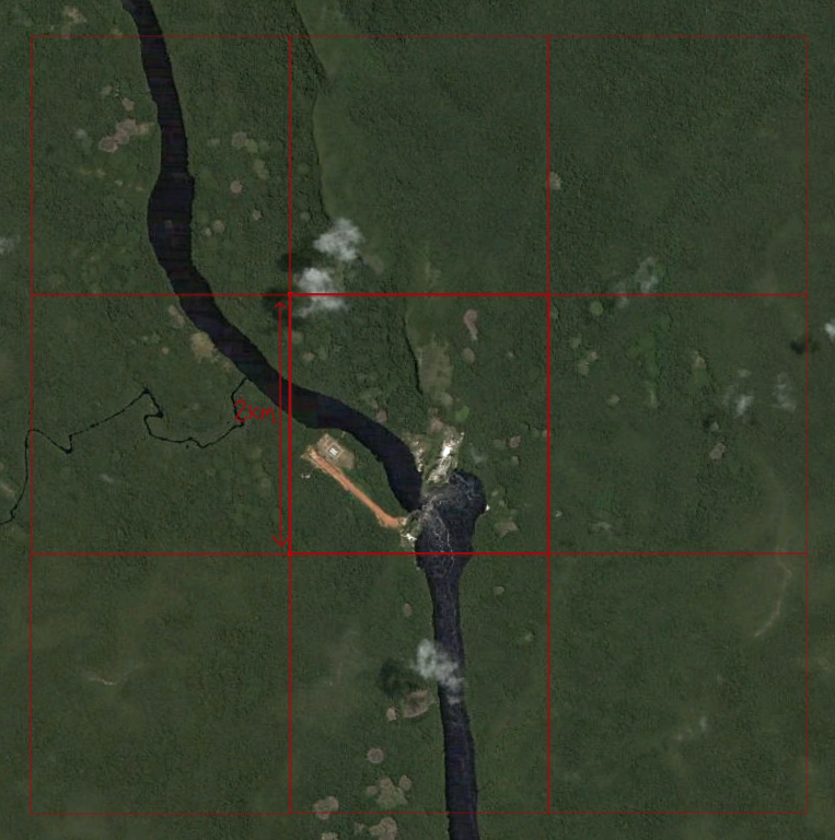
Heres the Lat/Long.
Heres the Map (2km grid)
Thanks.

Re: Someone with GeoControl to do heightmaps.
Posted: 2010-03-29 23:54
by Sniper77shot
I think no one will do it, but I have some helpful tutorials for you so you can do it yourself, they are a collection of the basic tutorials for what you are trying to do and a bit more an mapping.
https://www.realitymod.com/forum/f189-m ... heavy.html
https://www.realitymod.com/forum/f189-m ... rmaps.html
Re: Someone with GeoControl to do heightmaps.
Posted: 2010-03-30 00:06
by BloodBane611
Use these tutorials:
https://www.realitymod.com/forum/f189-m ... heavy.html
FH2 mapping tutorials - Create bf2 heightmaps with Geocontrol
All the programs involved are free, and while it's something of a pain, no one is going to do your work for you. If you spend an hour or two on this you will certainly find some success, it's really not that hard.
Re: Someone with GeoControl to do heightmaps.
Posted: 2010-03-30 00:54
by Wilkinson
Hah. this area was actually a spot I was thinking on mapping for the Venezuelan Armed Forces. Lemme know if this project picks up
Re: Someone with GeoControl to do heightmaps.
Posted: 2010-03-30 12:13
by EddieRizla
I realise that all the programs are free and it really isnt that hard to follow the tuts, but i was hoping someone else could of done it to help, because i dont want to waste a 30 day trail on one map and not being able to use geocontrol, for future projects.
Its not that i cant be bothered to do it myself. Its that i dont want to pay for the full program or use the trail just incase it is really just a 30 day trail and locks after the 30 days and even if reinstalled it still is locked.
Thats what happened to PS and i had to buy the real deal. I hope you understand now.
To Wilkinson, yeah i was trying to get to grips with making a tropical map and wanted to see if it could be to any use to a Community faction. I looked around in google earth but most of Brazil's borders dont really have hi quality satellite images. But i found this area and its got a pretty big *** river with rapids, which i was thinking about making the rapids on Qinling.
Is there a Venezuelan faction?
You can take priority for mapping this if you want i don't have much experience with doing jungles and rivers.
Damn thats alot of text. Its like a formal letter.
Re: [Request] Someone with GeoControl to do heightmaps
Posted: 2010-04-08 10:13
by nighthitcher
sounds good to me