
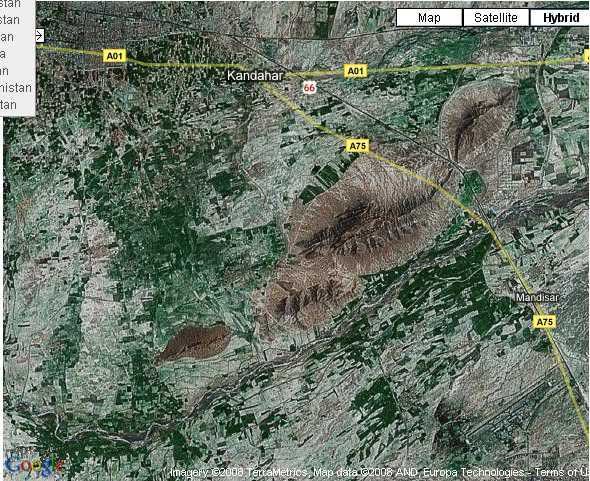
i think this region would be a good scenario for a scale4 kandahar region map:
the whole area.
this area would be good for a map imho.
rough layout idea:
kandahar airfield would be located bottom- center.
kandahar outskirts would be top left. (just outskirts because the inclusion of more than that would be just too much - maximum map size + performance + lack of statics..)
mandisar would be around the center.
plus lots of small settlements, compounds and agriculture etc as you can see on the pics.
note: the r/l area is about 12 times (rough estimation
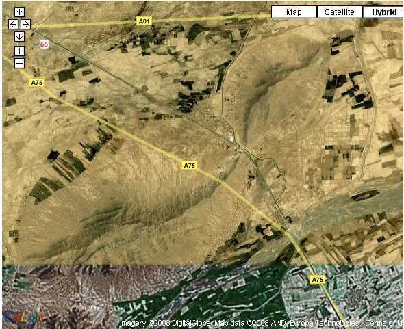
if we get this started, it would be just roughly orientated on that area anyways since you can't do something like that 1:1. you have to scale everything down, create some 'highlight points' etc., correct mountains and road allignment to get as close to the r/l thing as possible without getting a bad performance.
note also: i'm not saying i take this task, i have to finish some other projects first anyways. but i'm very interested in creating a map like this and i have lots of freetime very soon.
.. think you get it.
for the modelling part, this is my idea so far:
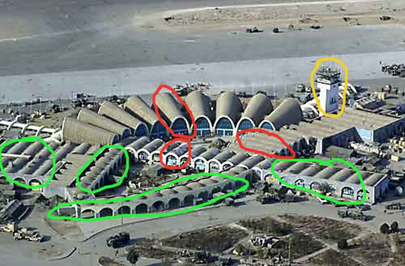
green: i have an idea how to go around modelling those objects but don't quote me on that yet, i'll look into it and let you know, don't hold your breath on that one so far i might be wrong..
yellow: would be nice to have, but maybe the xp airtower could do the job there.
red: those need definately to get done to get it correct imho. just one of each me thinks, so you can just allign them side by side.
wether if they are enterable or not is up to the modeler, i'd say it could be quite an easy model if closed, but i'm not a modeler. needs uv and textures as well of course..
plus some small, unique things like signes etc to get some atmosphere would be nice, but there are bigger obstacles at the mo..
that's it so far, again - i'm just dropping in my ideas and i would like to get this forward sometime soon.
 Project Reality: Dutch Armed Forces on facebook


