Western New York concept map, based on Monroe County NY
2km map
Factions: BLUFOR vs. OPFOR (maybe US vs. China, Russia, or MEC)
Game play type: Infantry, with some APC/IFV scout chopper support I'm thinking

So let me start by explaining that eyesore of a concept map, red areas are suburban areas, lime green represents tree lines, dark green is dense woods like if you mixed the kinds of woods you see on Militia maps and on Silent Eagle, blue is a creek with a waterfall in it, OD green is TBD but most likely lawns or the similar, the tan is fields, and the pink is potential flag area separation.
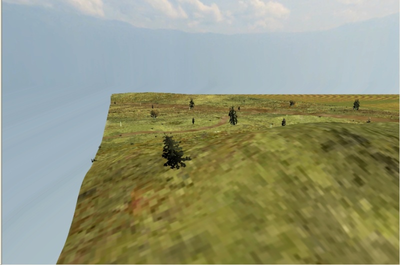
The inspiration for this map is where I live, since I started playing PR I've notice that the local area where I live might be a good place to create a map, so over the last year I learned how to create maps, even created my own CO-OP map.
The terrain I think will be somewhat unique to PR since there seem to be few maps there suburban, farmland, and woodland are mixed in such close proximity. Another unique feature that I like about the terrain is that the is a lot of natural areas ambushes or defenses could be set up. The terrain will be somewhat hilly consisting of hills as high as 50-100m, and oscillating between hilltops and bottoms regularly. As for the school, I was thinking of putting one in around there to add some suburban combat to a rural area.
Please comment if you have any suggestions or feedback on my concept.
*update*

*1-26-2013 update*
*3-16-13 update*